Agdam (Ağdam)
Aghdam (Ağdam) is a ghost town and the nominal capital of the Aghdam District of Azerbaijan. Founded in the 18th century, it was granted city status in 1828 and grew considerably during the Soviet period. Aghdam lies 26 km from Stepanakert at the eastern foot of the Karabakh Range, on the outskirts of the Karabakh plain.
Before the First Nagorno-Karabakh War, butter, wine and brandy, machine, and silk factories, an airport and two railway stations functioned there. By 1989, Aghdam had 28,031 inhabitants. As Azerbaijani forces withdrew from Karabakh following political turmoil in the country during the war, Armenian forces captured Aghdam in July 1993. The heavy fighting forced the city's population to flee eastwards. Upon the seizure, Armenian forces sacked the town. Until 2020, it was almost entirely ruined and uninhabited.
As part of an agreement that ended the 2020 Nagorno-Karabakh war, the town and its surrounding district came under Azerbaijani control on 20 November 2020.
The city's name is of Azerbaijani origin, meaning "white house", where ağ means "white" and dam is "house" or "attic", thus referring to a "bright sun-lit, white house" which was given by Panah Ali Khan of the Karabakh Khanate in reference to the Imarat cemetery. Another possibility presented by Azerbaijani authors is that it was derived from ancient Turkic glossary meaning "small fortress".
In November 2010 it was renamed by the NKR government to Akna (Ակնա).
Map - Agdam (Ağdam)
Map
Country - Azerbaijan
 |
 |
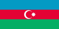
| Flag of Azerbaijan | |
The Azerbaijan Democratic Republic proclaimed its independence from the Transcaucasian Democratic Federative Republic in 1918 and became the first secular democratic Muslim-majority state. In 1920, the country was incorporated into the Soviet Union as the Azerbaijan SSR. The modern Republic of Azerbaijan proclaimed its independence on 30 August 1991, shortly before the dissolution of the Soviet Union in the same year. In September 1991, the ethnic Armenian majority of the Nagorno-Karabakh region formed the self-proclaimed Republic of Artsakh. The region and seven surrounding districts are internationally recognized as part of Azerbaijan pending a solution to the status of the Nagorno-Karabakh through negotiations facilitated by the OSCE, although became de facto independent with the end of the First Nagorno-Karabakh War in 1994. Following the Second Nagorno-Karabakh War in 2020, the seven districts and parts of Nagorno-Karabakh were returned to Azerbaijani control.
Currency / Language
| ISO | Currency | Symbol | Significant figures |
|---|---|---|---|
| AZN | Azerbaijani manat | ₼ | 2 |
| ISO | Language |
|---|---|
| HY | Armenian language |
| AZ | Azerbaijani language |
| RU | Russian language |


